Monday, June 21, 2010

DAY 49 FROM SOUTH TO NORTH - TOP END (NORTHERN TERRITORY) TRIP


12 June 2010

GURIG GUNAK BARLU NATIONAL PARK, COBOURG PENINSULA

A very early start today as we had to cross the East Alligator River at Cahill Crossing no later than 7.00am. It was pitch black when we got up. It was just getting light when we crossed over to Arnhem land - west Arnhem.


No way could you think of going in without a permit. So with permit C/127/2010 on hand we were on our way.


After crossing the river we boiled the billy and had breakfast next to the commonly seen sign in the Northern Territory.


It is double sided sign in most places. I don’t know how they expect you to read the reverse side when driving past them.


We had some time to kill as we were going to stop at Oenpelli. We had bought a permit for $13.30 each to be able to go to Injalak Arts and Crafts Centre. Well was that a take! I was under the impression that we would see them at work and have the opportunity to participate in what was going on. There were no locals demonstrating, or working in the centre. The art work –painted, woven- appeared to be mass produced – very similar works stacked in piles. The paintings at the centre though were in what is described as figurative x-ray style of the freshwater period. It was beautifully executed. According to the archeological team of girls that I met at the store who were working on the Injalak Hill rock site the pictures at the centre were exactly the same or very similar to the rock paintings. I question why should we pay to go to a centre that is primarily a local art outlet.


The drive up to Oenpelli was along floodplains,


billabongs,


stony country


and rocky escarpments.


The scenery was beautiful especially around Oenpelli itself.


If anyone passed us or came from the opposite direction the bulldust made you slow down as it was impossible to see because of the dust. So we would wait till the dust started to settle.


We were surprised to see someone cycling along such an isolated  road.


So after Oenpelli off we went heading north making our way past large wetlands interspersed with savanah woodlands. The smell of smoke was frequently in the air as we passed burnt or burning/smoking sections of the country side. We saw several dingoes on the way.


Across Cooper Creek we went


followed by the Causeway at Murgunella.


Again only a few birds at the water. The literature talks of abundance of bird life in the wetlands up north. We have definitely not seen an abundance of birdlife. We’ve seen a smattering of bird life at each wetland area.


The ‚rainforest‘ either side of the Causeway was certainly a change of scenery.


Murgunella must be of reasonable size as it its own airstrip as there is another strip not that far away at Smith Point.  We couldn’t enter the community so we did not know how big it was.


Finally the entrance to the national park. Over a grid and past a vermin fence and we were in.


Hubby had been commenting that there were no termite mounds along the way. Once in the park there were quite a few of them and quite large ones as well. There were some magnetic mounds just past Oenpelli and then only an occasional little one that we could see.


The Kapok flowers are out and the bush has lost its leaves indicating the dry season is really here. The bushes/trees were interspersed between bigger trees.


Finally we arrived at Black Point but there was no ranger in sight. So we registered and drove on to Smith Point campsite 1 as this was a generator free area.


So here we are finally – 570km north east from Darwin. It was 274km from Cahill Crossing and it took us 6 driving hours to do as we took our time and absorbed the scenery as we went.


After setting up camp in a lovely campground we walked across to the beach that is about 300 metres from us.


There are so many tiny flowers and butterflies fluttering between them.


As we watched the sunset


flocks of birds kept passing by.

Thursday, June 17, 2010

DAYS 47-48 FROM SOUTH TO NORTH - TOP END (NORTHERN TERRITORY) TRIP


10-11 June 2010

KAKADU


A few blogs ago I mentioned hubby referring to a fan palm. Well guess what – at hidden Valley the palm that he remembered was growing right next to our cabin.


After checking in with North Land Council regarding our permit to Nhulunbuy and dropping in at an aboriginal arts and crafts outlet where hubby had a lesson on playing the didj we headed off towards Kakadu past the new roadworks. I just loved this overpass.


We stopped on the way to get lures from the Lure factory and made it as far as Corroborree Park for the night. This is a lovely inexpensive camping spot that beats most of the national park camping grounds and is cheaper.


It is expensive to go into Kakadu for those of us not living in the Northern Territory. A lot of people were complaning as they were payong for a 14 day pass but most things are still closed. Many said they did every walk they could, visited every place open and found that after two nights in the park they had exhausted what they could do.


At Mary River National Park roads were closed to everything except Shady Creek. This is primarily a fishing area.


Driving between Darwin and Jabiru we crossed five big rivers that have huge floodplains that create a great expnase of coastal wetlands. These wetlands are amongst the biggest in the world.


We drove into the park and checked out the static information display. Two mile hole, Four mile hole and West Alligator Head still closed. So on we went to Mamukala wetlands.


The wetlands were beautiful. The information wall was splendid.


The walk was closed.


There were very few birds to be seen.


Those large lily leaves that we had seen not that long ago on Corroborree Billabong had all died here. The dry season was underway and it wasn’t taking long for the environment to change.


We dropped in at the Bowali Visitor Centre.


The display was interesting and the Aboriginal Art Gallery cum shop was expensive.

Several quotes on the wall - sharing of wisdom regarding looking after the land - struck a chord with me.


We drove to Jabiru – I was somewhat disappointed as I expected it to be a bit bigger and to have more of a shopping area as it is so close to Ranger Uranium mine. We visited the bakery for lunch and were joined at the table by this lovely bird that I can’t seem to identify using my bird field guide.


After lunch we drove to Cahill Crossing to check it out.


Down river from the crossing over East Alligator river was an overturned car. Apparently in April this year someone borrowed their grandfather’s car and tried to get across the crossing at high tide. We saw a picture of it when it happened.


Upstream a little from the crossing was a crocodile resting on the bank. Apparently he is a local here and is known as Eric.


The scenery from Jabiru to here was quite different. We were on the edge of an escarpment.


Then onto the Border Store for some icecream before going to Ubirr. Ubirr was spectacular. It is an incredible mesh of culture and landscape with the two totally entertwined. For us it is the beauty of the environment , the landscape and the rock art is the culture. For the locals the landscape is part of their culture and the rock art is a means of passing information on from generation to generation about the creation stories, and stories of how to live.


The rock art paintings were just so powerful. The one below was doen high up on an overhang of the rock shelter.


The setting further enhanced the stories behind the paintings.


In this setting it seemed strange to see a drawing of the Tasmanian Tiger.


Often paintings were overdrawn. Apparently once the story was told it was not important to preserve that drawing and often another would be drawn over the top when other information was being passed on.


We were very lucky that we got to Ubirr in time to hear the Ranger’s talk at the various galleries.


We first heard about the creation time and Rainbow Serpent stories at Rainbow Serpent Gallery.


At the main gallery we heard about the menu of the local people.


All the galleries were so different. The Crosshatching gallery was the last one we visited on the way to the look out for sunset.


We slowly made our way up to the lookout.


The view was just incredible - scarpment to one side, massive floodplains in front of us. There was the lower level lookout, where I stayed


and the higher level lookout where hubby went.


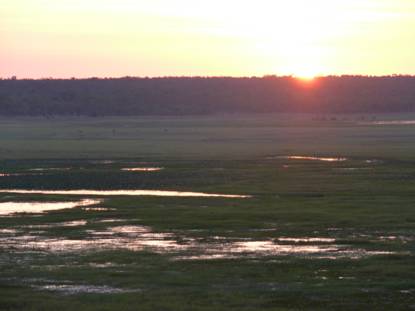
As the sun set it light up the wetlands.


It was just spectacular.